An exciting new pioneering initiative gives SCAD students the opportunity to become dynamic visualization artists who are technically proficient in visual design aesthetics that synthesize ‘big data’ in solutions for emerging design needs while reaching broader audiences with compelling user-friendly experiences.
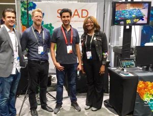
SCAD’s unique collaborative partnership with Esri, the world’s foremost designer and supplier of GIS software, brought SCAD students and faculty to the 2017 Esri Federal GIS conference in Washington, DC on February 13-14, 2017, attended by over 4,000 federal employers. In a unique display of SCAD’s innovative prowess, students led by architecture and urban design professors Christine Wacta and Ryan Madson and chair of interactive design and game development chair, SuAnne Fu, displayed a dazzling array of experiences combining GIS mapping, 3D-modeling and interactive visualizations.
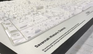
Christine Wacta and her students generated City Engine files from which SCAD’s Digilab printed a 3-demensional 1:1500 scale model of downtown Savannah demonstrating GIS as powerful means of visualizing, analyzing, and interpreting data. Using this means of mapping, organizations can recognize relationships, patterns, and trends in profound and impacting ways. The 24 SF 3-D model was displayed in the “drone zone,” where drone operators experimented with scanning technology, showcasing 3D printing as an emerging tool for urban planning and design. This was the first time a working model of  this scope, accuracy and flexibility was displayed at a GIS conference.
SuAnne Fu guided students to create a stunning exhibition of both virtual and augmented reality experiences for conference attendees. Her team brought together two experienced faculty from separate digital media disciplines: interactive design and game development professor, Aram Cookson and visual effects professor, Bridget Gaynor to lead the courses. With their combined expertise, the students created a unique data visualization program which allowed users to enter an augmented reality environment using a Microsoft HoloLens or a virtual reality environment using an Oculus headset. The AR model allowed users to scale the city and visualize data in different categories. The VR program allowed users to explore the city of Savannah and view data through voice-command data filters. This cutting-edge approach to interactive data visualization was so impressive that even Esri’s software developers were impressed.
“I am a current software developer at Esri, and was fortunate enough to meet the group of SCAD students presenting their VR demos at FedGIS this past week. I had the chance to interact with their Unity and Unreal Engine-based demos, and it was an incredible experience. As a developer who dabbles in VR, it was personally exciting. But, to see the application potential using GIS made me ecstatic!” – Jackie Roberts, Software Developer, Esri DC
Following the FedGIS conference, Professor Wacta and chair of the motion media program, Kelly Carlton, successfully developed live demonstrations of the use of projection mapping at both the Esri Imaging and Mapping Forum (IMF) and the 2017 Esri User Conference that were held in San Diego July 10-14, 2017 and attended by over 16,000 design professionals and students. The response has been nothing short of remarkable.
Ivan Chow is Dean of the School of Building Arts at SCAD.


